The Pemi Loop is a 30-40 mile (depending which summits you hit) classic NH backpacking trip that hits the 11 summits that ring the Western Pemigewasset Wilderness. With a free weekend and a great forecast, I decided I wanted to try it in two days. So, with my pack weighing in at 22.8 lbs with full food and water, I set off.
Along the way, I tagged 12 official New Hampshire 4000 footers (Flume, Liberty, Lincoln, Lafayette, Garfield, Galehead, N Twin, S Twin, Zealand, West Bond, Bond, and Bondcliff), as well as two unofficial ones (Little Haystack and Guyot).
Day 1: Flume, Liberty, Little Haystack, Lincoln, Lafayette, Garfield, Galehead, South Twin, North Twin
I got started at 5am on Saturday morning. I decided to do the loop clockwise, hitting Franconia Ridge the first day and the Bonds on the second, staying at the Garfield Ridge Camp. Not sure why, I guess there's just something natural about going clockwise? Also, there's a bigger elevation change on the Franconia Ridge day, so it made sense to do that first. I made great time up the flat Lincoln Woods trail to the Osseo Trail, where my climb of Mt Flume began. Doing it clockwise, Flume is the biggest elevation gain of the whole trip, ~3200'. I met and kept pace with an ultra runner on the way up Flume, resulting in me summiting around 8am, more than an hour ahead of schedule (in retrospect, a bad idea).
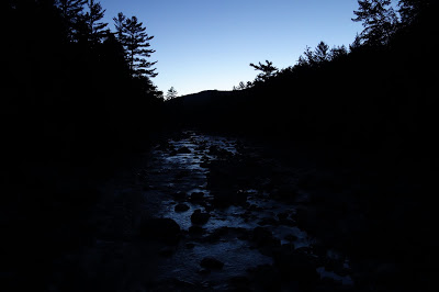 |
| Early morning light on the Pemigewasset River near Lincoln Woods |
 |
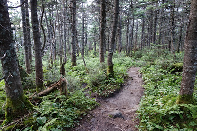
| Smooth sailing up the Osseo Trail |
 |
| More ultra runners near the summit of Flume |
 |
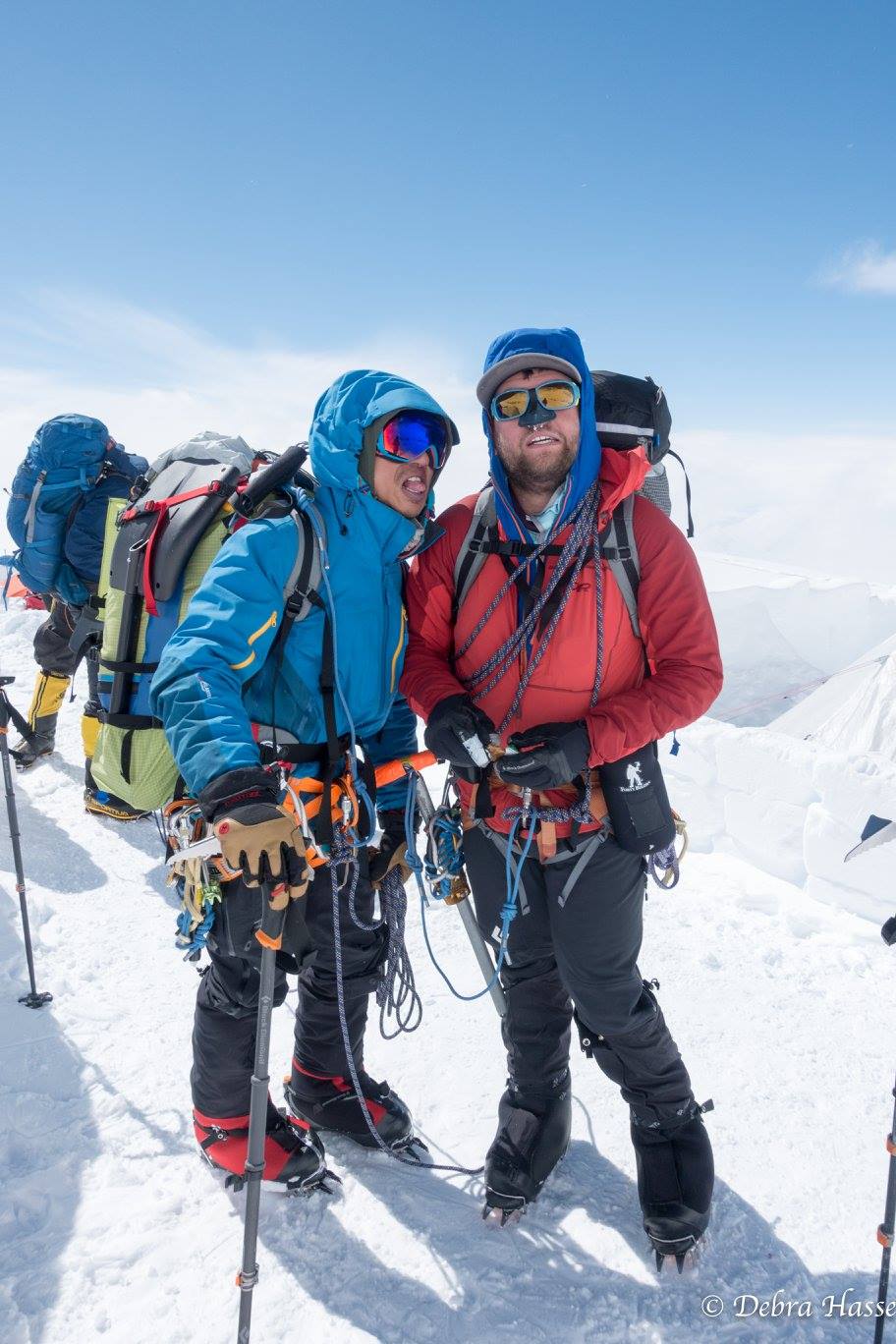
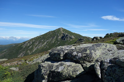
| Unknown hiker on the summit of Flume, looking toward Franconia Ridge |
 |
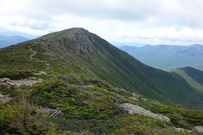
| Franconia Rige, Garfield, and North Twin in the distance |
 |
| First summit of the day! |
After resting and eating on the summit of Flume, I hiked over to Liberty. It's about 1.5 miles and a little under 600' of elevation gain along the Franconia Ridge Trail. I met more ultra runners, and learned there was a 32 mile (14k elevation gain) trailrace going on that day. People were going up Little Haystack, down Flume Slide, back up Little Haystack, over Lincoln, down Lafayette, up Cannon, down to Lonesome Lake, then up Kinsman and finally back down. I got out of their way whenever I could.
 |
| Summit of Liberty looking up toward Lincoln and Garfield. North and South Twin can be seen in the distance |
From Liberty, I continued on over Little Haystack to the summit of Lincoln, where I stopped and ate. Up until this point, I only had ultra runners for company (who were making me feel very inadequate). Once I reached Little Haystack, I hit the crowds. Franconia Ridge is deservedly one of the most popular hikes in the White Mountains. Especially on a day like this one, I was bound to have company. Following the summit of Lincoln, I made quick time up Lafayette. This is where I would say goodbye to the crowds, and the nice trail.
 |
| Looking up at Lincoln from Little Haystack |
 |
| Looking back at Flume and Liberty from Little Haystack |
I left the summit of Lafayette at 11:30am, having been on the trail for 6.5 hours. I was on my way to Garfield, which involved a heinous descent off the north ridge of Lafayette into some gnarly terrain, even for White Mountain standards. It took me just about 2 hours to go the 3.8 miles and 1000' gain to reach the summit of Garfield. At this point, my water was running dry. I was looking forward to refilling at the Garfield Ridge Camp, just a quarter mile away.
 |
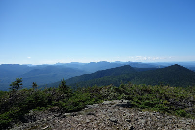
| From whence I came: Flume, Liberty, Little Haystack, Lincoln, and Lafayette from Garfield |
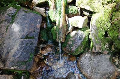 |
| Clever bit of engineering at the Garfield Spring |
 |
| Gnarly trail leading down from Garfield Ridge Camp |
I stopped for a while at the Garfield Spring, deciding what to do. This is where I planned to camp, but it was only 2:15pm. I had a few rugged miles ahead of me to the Galehead Hut and Galehead Mtn, but I had at least 6 hours of daylight left. I was only carrying a bivy sack instead of a tent, so I was pretty flexible about where I slept. I also knew that the next day had a 40% chance of rain. I eventually decided I should keep going as long as I could, and knock off as much of this trail as possible before dark.
It turns out, that section between Lafayette and South Twin is soulcrushing. Rugged and steep with lots of up and down, it took me another 2 hours to go the next 3.6 miles to the Galehead hut, arriving there around 4:15pm. I dumped my pack at the hut and took the quick side jaunt up Galehead (0.5 miles, 300') I came back and drank as much water as I could, then refilled. It was 4:45pm, and I wasn't anywhere I could easily camp (no camping allowed within 0.5 miles of the hut). I decided I still had 3.5 hours of daylight left at least, I was going to climb South Twin. All the trip reports, and even some conversations I'd overheard at the hut seemed to suggest the ascent of South Twin would be a crux of the trip. People were complaining about how steep and nasty it was, gaining 1200' in 0.8 miles. I figured even with how tired I was, I could probably do 1200' in 3.5 hours, so I started off.
Turns out, it was pretty much a breeze. I didn't realize at first that the AT climbs South Twin from the Galehead Hut. Sure, it was steep, but it was nowhere near the kind of rugged trail that I found between Lafayette and Galehead. I summited South Twin about 5:35, a little less than an hour after I started up from Galehead. Now I decided I could take a decent break.
 |
| Lounging on the summit of South Twin |
 |
| "Light and Fast": well deserved recovery food |
I hung around the summit of South Twin for an hour or two, then I started to get cold. The sunset colors I was hoping for hadn't really shown up, so I decided to pack up and head for North Twin. North Twin is a 2.6 mile round trip spur trail from the regular Pemi Loop, but I had time and nothing else to do. I pushed on and summited North Twin just in time for a great sunset over the Green Mountains.
 |
| Evening light on the Presidentials from South Twin |
 |
| Refreshingly nice trail on the North Twin Spur |
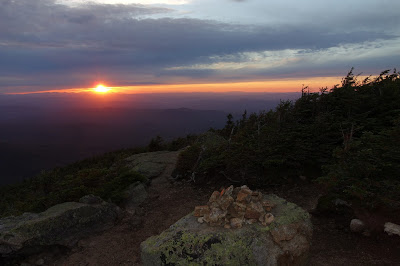 |
| Sunset from the summit of North Twin |
 |
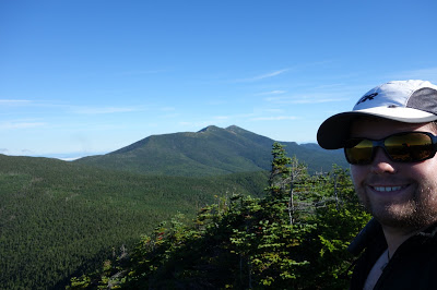
| Last summit of the day selfie! |
 |
| Sunset over Camel's Hump and Mansfield |
I had passed a nice little bivy spot along the North Twin Spur, so once the sun fully disappeared, I headed down and threw down my sleeping bag. I had a bivy sack, but it with no rain in the forecast, I decided to start out laying on top of it.
There are many nice things about going solo in the mountains: you move quickly, the decision making is easy; it's almost meditative. That being said, bivying alone isn't one of them. My imagination played many a trick on me, amplifying every rustle I heard in the woods. Luckily, the rest of my body was too tired for such foolishness, and I fell asleep pretty quickly.
 |
| Camp for the night |
Day 2: South Twin (round 2), Guyot, Zealand, West Bond, Bond, Bondcliff
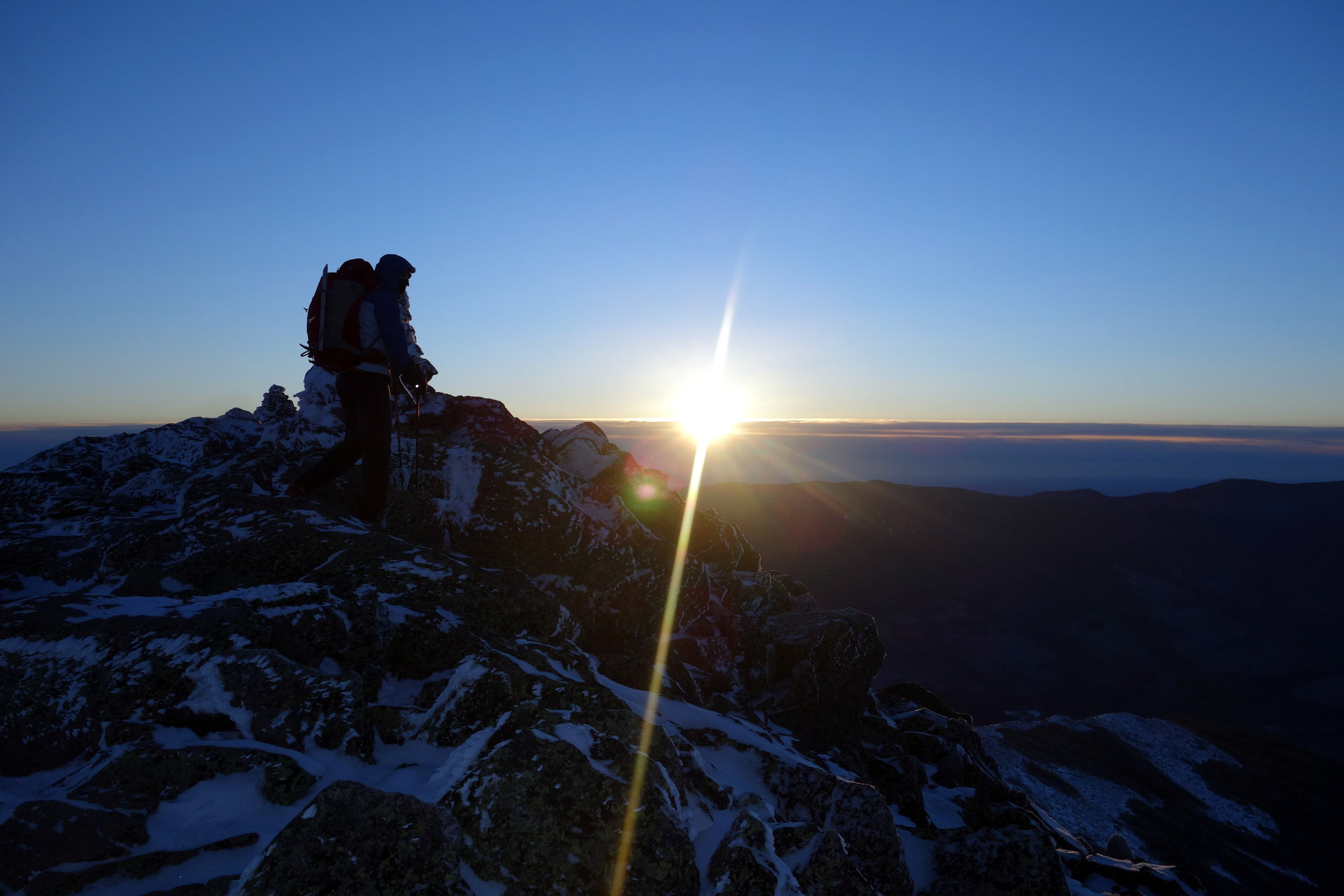
I awoke ahead of my alarm at 4:30am. I ate, packed up camp, and heading back to the summit of South Twin hoping to catch the sunrise. Unfortunately I made it there too early! Instead of waiting around and getting cold, I struck off toward Guyot. The Twinway is a wonderful trail, I made good time cruising along its little ups and downs. I hit the summit of Guyot, and decided to head off on another side trip to Zealand.
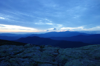 |
| Early morning light on the Presidential Range |
 |
| Nice trail along the Twinway toward Guyot |
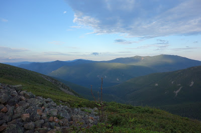 |
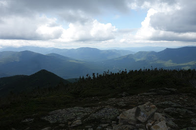
| Looking back at what I did yesterday from Guyot. |
The hike to Zealand was NOT worth it. It's another 2.6 mile RT side trip that loses and gains around 900' on a steep trail covered with large boulders. It really was like talus hopping. The whole time I was descending toward the saddle, I was thinking how painful it was going to be heading back up. Turns out, the summit of Zealand is worthless as well. Given how it's pretty easily accessible from the Crawford Notch side, I would avoid going to Zealand during a Pemi Loop hike unless you're a glutton for punishment.
 |
| The inspiring summit of Zealand Mtn |
Having lost 2 hours on that side trip, I wanted to push on. I knew the rain was coming; I could see the clouds building. I needed water though. I was planning to fill at the Guyot Tentsite, since my last water fill was at Galehead Hut the night before. I met some AT thru-hikers on the turn off to Guyot Tent site, and they told me it was 0.5 mile steep descent down to the spring: pretty miserable.
I took stock of my water supply; I had a little less than 1.5 liters and 3 more summits to go. I checked the map to see where the nearest water on the descent was, and found that the Bondcliff trail crosses several streams, the closest being about 1000' feet from the summit. At most a 3 hour trip for me. I decided to forgo getting water at Guyot Tent site and headed toward West Bond.
Unlike Zealand, West Bond is worth the trip. It's about 1 mile round trip, maybe 400' of elevation gain but to a cool, rocky summit with great views. One thing I had a great view of was the approaching rain, so I didn't linger on West Bond for long. I headed back and up to Bond, where I didn't linger much either.
The last summit of the trip for me was Bondcliff. Bondcliff is an exposed summit with an airy feel due to the titular precipice on the western side. I booked it down the trail from Bond and up to the summit of Bondcliff, where I was able to take a breather for a minute before heading down to avoid the oncoming rain.
 |
| Bondcliff from Bond |
 |
| The last summit of the trip |
 |
| Hikers coming up from Lincoln Woods, and the approaching rain |
 |
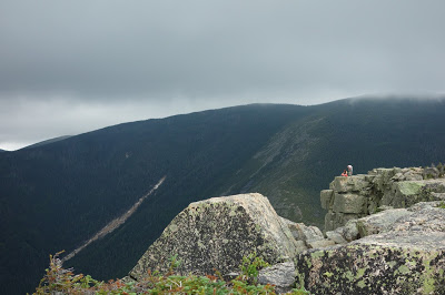
| Looking at the Southern Whites from the summit of Bondcliff |
I didn't stay on the summit of Bondcliff long. I started down around 11:30am, 6.5 hours after leaving my bivy site. Unfortunately, I didn't have anything to look forward to. The descent back to Lincoln Woods from the summit of Bondcliff is long. A little over 9 miles and 3200' of elevation loss long. Motivated by the rain and the promise of water, I moved at a quick clip. I hit my first stream crossing about 30 minutes into the descent, but it was dry.
 |
| Rain showers and thankfully nice trail for the descent off Bondcliff |
 |
| First stream crossing: dry. Womp Womp |
 |
| Second stream crossing: Nope |
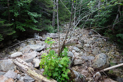 |
| Third stream crossing: nada |
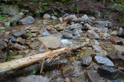 |
| Fourth stream crossing: Yay! |
After 2 or so hours and about 2500' lost, I finally found water. I drank about 0.5 liters, which was all my stomach could handle, and then refilled my camelbak. At this point, my feet were in the most pain. Not due to blisters or anything really treatable, just bruising from the sheer amount of pounding I'd subjected them to up to this point. I limped along down the Bondcliff trail for another 1000' feet or so, until I finally reached the Pemigewasset River. From here, I had about 5.5 miles of what's essentially rail-trail. The Bondcliff trail hikes out an old railroad bed all the way back to the parking lot. I ripped off my boots and dunked my feet in the cold water.
 |
| "NH Fish and Wildlife Commission is reporting fish in the Western Pemigewasset River dying off at unprecedented rates. Cause Unknown." |
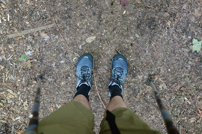
I was dreading putting my boots back on, when I had an epiphany. I'd carried camp shoes with me this whole way, but never used them. They just so happened to be ultralight minimalist trail runners. With perhaps the best idea I've ever had, I switched to my camp shoes after soaking my feet, and cruised the last 5.5 miles back to Lincoln Woods Trailhead.
 |
| Happiness is a different pair of shoes... |
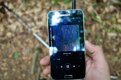 |
| ...and Alt-J, cause I was sick of nature. |
I reached the parking lot at 3:20pm, just about 10.5 hours after leaving camp. The whole thing was 39.2 miles, having done 10,869' of total elevation gain. I didn't count any elevation loss, so total elevation change was more than that, probably close to twice more.
All in all, there are few things I would do differently next time (hah). As I mentioned, I would not go to Zealand. It just wasn't worth the work it took to get there. My equipment was tailored perfectly for the weather and temperatures I had, so I wouldn't change much there. I could have gone lighter, but some of those creature comforts were very welcome (like the burrito ;) ). I don't know if I would have filled at Guyot Tentsite or not. The hike did sound miserable, and I never truly ran out of water on the 2nd day. I had to ration it more than I would have otherwise, but the added time, plus the speed from having a lighter pack may have made up for it. One thing I might do next time is bring a pair of running shoes (or a mountain bike) and stash them somewhere along the rail trail for the way back to the car. I was lucky to have camp shoes that would work, it would have been much more miserable if I'd brought flip flops instead.
It was a fantastic weekend. I'm probably not going to hike for a while though.