Presidential Traverse
 |
| Mt. Adams and Mt. Washington from Mt. Madison |
My dad and I had wanted to make a
large trip together for some time now. I
really wanted to climb some alpine ice, and I had been itching to get back to
Chamonix since my first unsuccessful trip in 2010. He decided we’d do it the rich man’s way (as
opposed to the poor college student way which I tried the first time) and spend
some time acclimating in Colorado before heading to the Alps. Since he was paying, that was fine with me.
Health has long been a challenge
for me on big trips, as I’m constantly battling anemia due to a chronic
illness. Even so, I was decently fit,
and had done the Presidential Traverse the previous Saturday with some friends
from Dartmouth.
Rockies
I flew from New Hampshire to Colorado on Friday before Labor
Day, and met my parents and sister in Summit County. They were just returning from a few days
spent climbing the Wilson group in the San Juans. They weren’t terribly interested in more
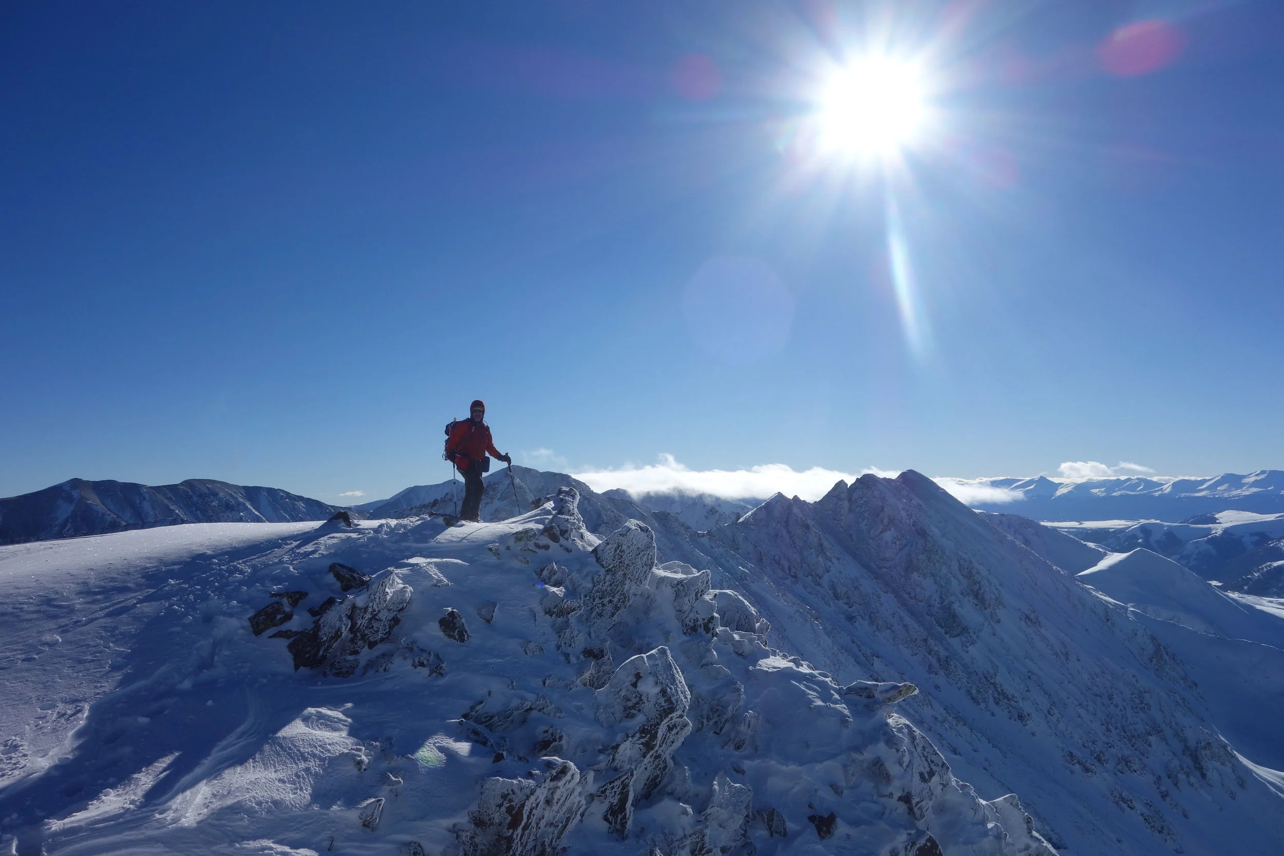
mountains, so I set my sights on something close by I could easily solo. I decided on the West Ridge of Pacific Peak
(13,950’), a moderately exposed scramble up “ok” rock to an exciting
summit. I thought if I was feeling up to
it, I’d continue on over to nearby Atlantic Peak (13,481’) another of
Colorado’s highest 100 peaks.
 |
| Sunrise on the lower West Ridge of Pacific Peak |
 |
| Looking down the ridge toward the first tower |
I left our
house in Dillon around 2:30am, and with a stop to get some munchkins from
Dunkin Donuts, I was at the Mayflower Gulch trailhead around 3:30am. Gaining the ridge requires a bushwack through
the willows below Mayflower Gulch following Pacific Creek as it cascades down
from the saddle between Pacific and Atlantic.
Despite the gnarly willows, I made good time up to the base of the
ridge, and had completed a decent portion of the lower ridge by sunrise.
The lower part of the ridge was a little more challenging
than the upper part. I stayed as close
to the crest of the ridge as I could; though the climbing was harder, the rock
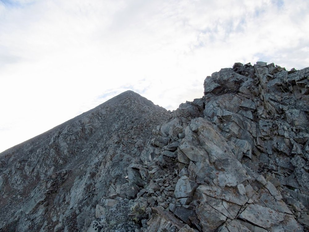
was more solid and overall less miserable. The ridge consisted of three steep towers
separated by stretches of class 2+ scramble-hiking. I passed the lowest tower and the highest
tower on the right, and passed the middle tower on the left.
 |
Looking up the ridge toward the summit of Pacific Peak
|
Once passed the towers, I again made quick time toward the summit. The climbing was much more loose, but the danger of a long fall was over. I scampered up the final 500' or so and into the distinctive notch just southeast of the summit. This notch is impressive, it's very narrow and looks down almost 1000' on either side. A few more class 3 moves brought me to the summit of Pacific Peak, where I ate some celebratory donuts and took some celebratory selfies. Despite having a house so close to this beautiful mountain, this is the first time I've ever been to its summit.
Since I was feeling pretty strong, I decided to head over to Atlantic Peak. The hike between Pacific and Atlantic is no harder than class 2, and goes very quickly. All in all, I probably lost and then gained maybe 500' between the two summits. I had great views of the West Ridge of Pacific the whole way up, however.
 |
| Celebratory selfie on the summit of Pacific Peak |
 |
| The West Ridge comes off the summit from the left |
I was planning to descend the West Ridge of Atlantic Peak back down to Mayflower Gulch and get to my car, though a few hundred feet down the ridge I noticed just how close the top of Mayflower Gulch looked. In a moment of uncharacteristic stupidity, I decided to descend straight down a scree gully and pick up the Mayflower Gulch trail much higher in the gulch, thinking it would save me time. Boy was I wrong. The scree gully quickly became very steep and ended with a 50' cliff. After pacing back and forth at the top of the cliff looking for an easy exit, I decided my only option was to down climb. By this time, I had developed a bit of an audience of day hikers down in Mayflower Gulch, and was greeted with cheers when I arrived at the base of the cliff unharmed. It remains one of the most harrowing descents I've ever made. Thankfully it ended happily.
 |
| Looking back up Mayflower Gulch toward the face I descended |
Alps
A day later, Dad and I pack up and jump on a plane to Geneva. We were keen to avoid losing any of the acclimation we had gained in Colorado, and so after an overnight flight, we landed in Geneva and within a few hours we were in Chamonix and heading up the Aiguille du Midi Telepherique. We wasted no time getting geared up and headed down to the Refuge des Cosmiques just in time for dinner.
 |
| Late afternoon on the Aiguille du Midi |


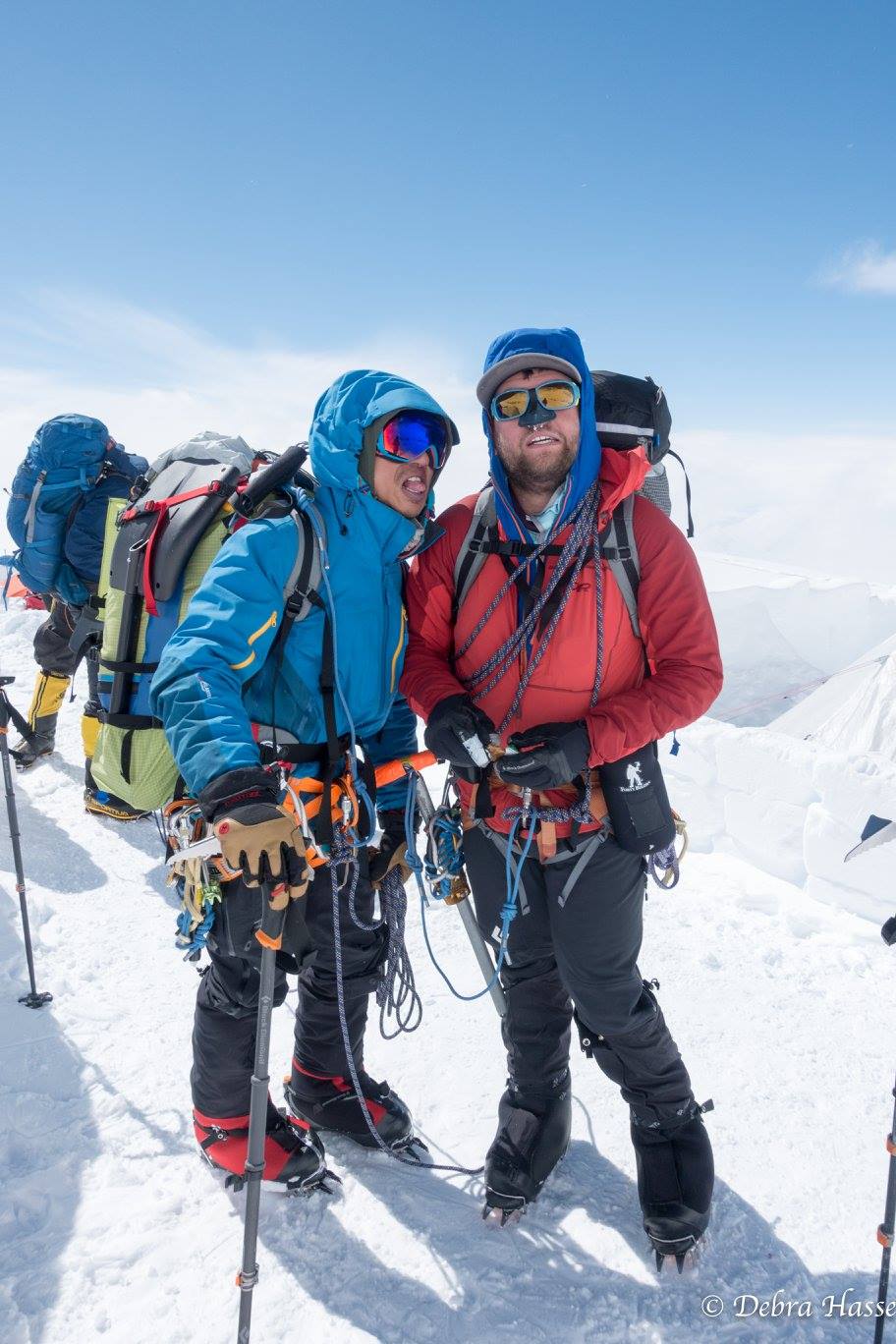
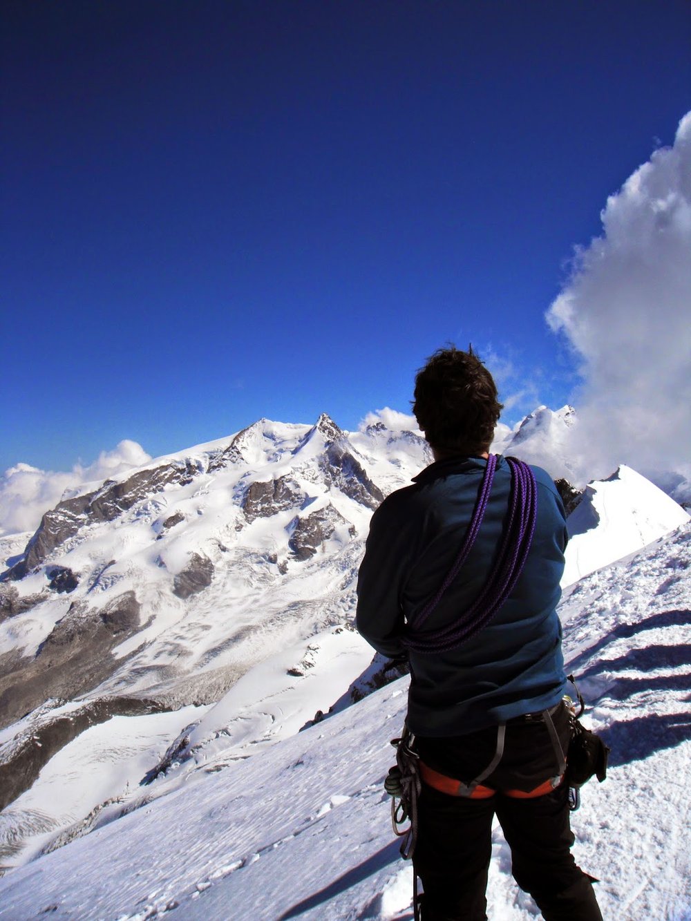
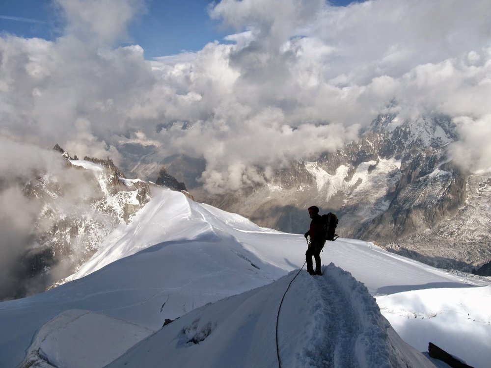
We had several objectives in the Midi Basin. First we were after the short classic, the Cosmique Arete. This jagged ridge has an excellent mix of snow and ice terrain, culminating in an exciting climb up a rickety old ladder directly to the observation deck at the Aiguille du Midi lift station. Then over the next several days, we wanted to climb the Contamine-Mazeaud, a snow and ice route up the north face of Mont Blanc du Tacul, and finally, the Trois-Monts Traverse. The Trois-Monts Traverse goes over the three highest summits of the Mont Blanc range on the way to the summit of his majesty himself, le Mont Blanc.
Unfortunately, unseasonable snow conditions made the avalanche danger too high, and we were unable to attempt the Traverse.
 |
| Dad leading the crux rock pitch on the Cosmique Arete |
Excited about our successful climbs on the Cosmique Arete and the Contamine-Mazeaud, we weren't ready to leave the Alps just yet. We still had 3 days on our trip, and so we decided to pack up and head to Zermatt for an attempt on the Matterhorn. The following day, we arrived at the Hornlihutte, a climber's hut at the base of the Hornligrat ridge on the Matterhorn. The views from here are breathtaking.
 |
| North Face of Mont Blanc du Tacul |
 |
| Leading the crux steep section on the Contamine-Mazeaud |
Early the next morning, we left the Hornlihutte and headed up. Unlike the routes on the Mont Blanc Massif we'd been doing, the Hornligrat is mostly a snowy rock climb. The climbing is easy enough that most everyone does it unroped. It reminded me a lot of the Maroon Bells during a heavy snow year. Steep, loose, and fun. Unfortunately, I was having some major trouble keeping up. Unclear whether it as altitude or another health problem, we decided to abandon our attempt early on. Determined to make the most of the day, however, we headed toward a nearby peak, Breithorn, which is still 4000m, but much much easier by it's standard route. It's basically a glacier slog from the top of a lift. All in all, it was a nice consolation prize after my failure on the Matterhorn. With that, it was time to head back to Geneva to catch our plane home.